
What a four day Easter weekend I had. I quickly slapped together a route that should take me about three days if fit enough. Made sure to take all the back roads to avoid the holiday traffic. Only using main routes when there was no other way round. Packed very little in my bags. Only packing a jacket, T-shirt, sweat pants, first aid kit, chargers, solar panels,new sleeping bag, tent just incase I did not land in the right place at the right time.
Starting off on friday with a nice low heart rate making sure that I would be able to maintain it for a few days. First heading in the direction of Marble Hall along my normal training route. Swung left on a gravel road to wards Roedtan.
Stopped at Roedtan for lunch. Not really a town. It has more than one petrol station and a few shops. Village is over shadowed by a Grain silo. From here I sped along a flat road towards Zebediela.
As I passed Lebowakgomo people started to pass comments of surprise to find a white man on a bicycle.
Once the sun had set it was quite clear as to where the villages were and the cattle grazing areas lay. Here I picked a nice bushy section that was surrounded by thorn trees to set up my tent. There was a wonderful full moon that made it not necessary to use a torch. Laying on my back with the tent door open, watching the clouds moving in front of the moon and stares. This made me drift off to sleep with such a relaxed feeling.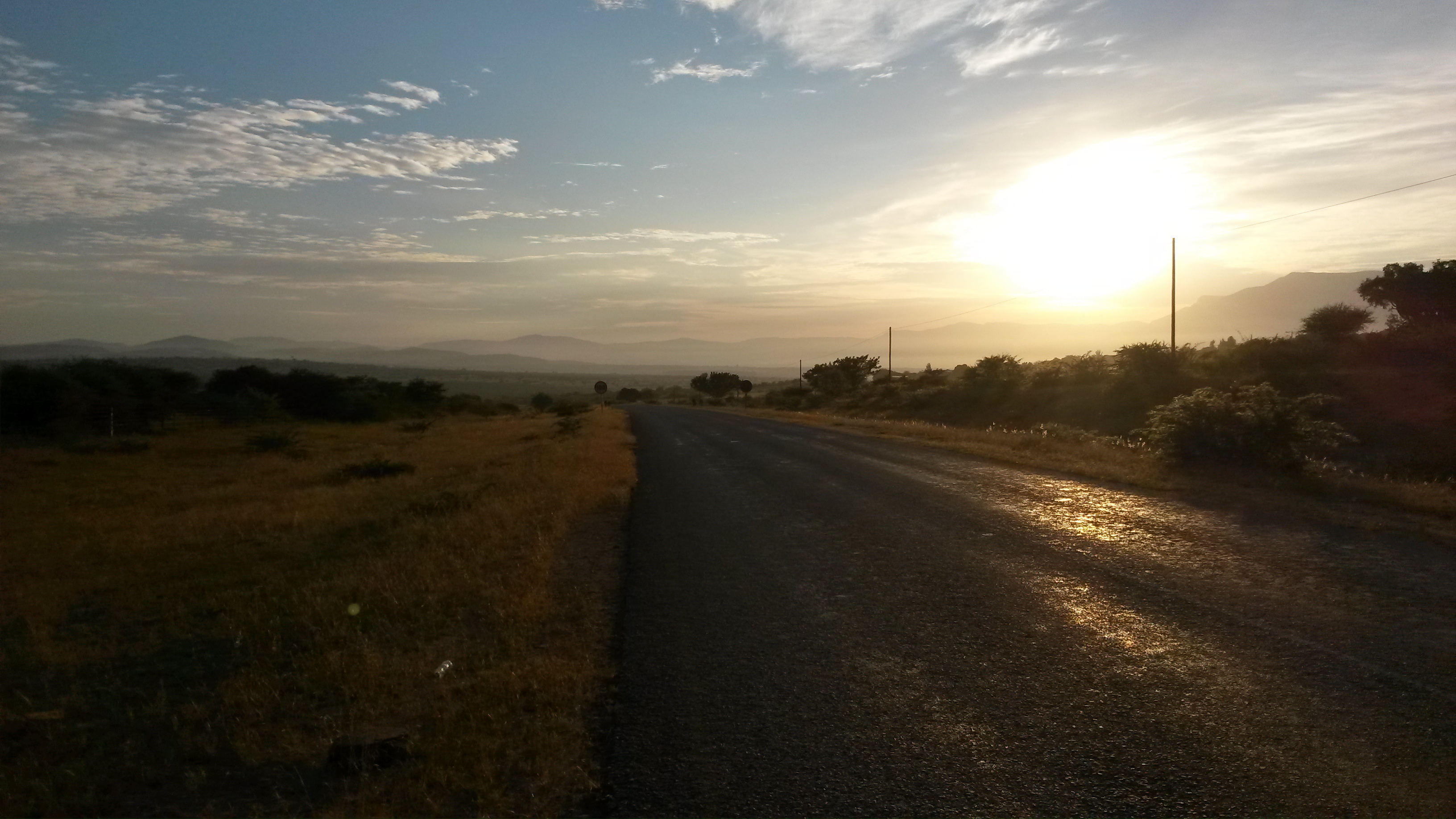
This is the sunrise next morning back on the road. Slept in the bush on the left of photo.The hills started to rise so that the road had to snake through them.
Coming up one rise I realized that this place is Moria. The place which the religious group ZCC pilgrims to every Easter and Christmas in their millions. The week after I spoke to a fellow worker who went there. He said there were over 13 million people in attendance for the weekend.  The smoke from the cooking fires was drifting on the wind down the valley. The night before I had thought there might be a run away fire as I could smell the smoke drifting on the air.
From here the road rises to the Haenertsburg.
This was the highest point before dropping off the escapement down the Magoebaskloof pass to Tzaneen.
Tzaneen is a very tropical part of the country. Been one of the high rainfall areas of South Africa with a mild temperature. There are lots of road side farm stalls selling the fruits that are grown here. Here is a short list of some of the fruit: bananas,mangoes,pine apples,oranges,avocado pears and grape fruit. See there is a very large tea plantation.
Stopping for lunch at KFC in Tzaneen. Took a little time out and fulled up on water to cross the lowveld. There were more down hills towards Letsitele, Gravelotte and mica. This stretch had lots of orange farms and then the game farms start. 
At Mica I found this sign post. If you go down that road you will be entering the Kruger National park in about 60 km. This is one of the world renowned national parks. Home to Elephants and Lions or should I say Africa at its best.  Also found this sign for Foot and mouth control. This is a disease that is controlled by the government. They try to contain it in the areas were there is a lot of wild animal movement. The movement of wild animals makes it very difficult to control. They need to control this disease otherwise other countries will not import meat products from South Africa, if there is no controls in place.The road down to Hoedspruit is lined with nine foot game fences. Making it feel like you are passing down no mans land at a country border.
Rolled into Hoedspruit not long after dark. Here ordered a pizza and booked into a Hotel. It was good to have a hot shower and scrub two days of sweat and dust off. Washed my cycling clothes, as the cycling kit I had on was the only set I had. Nice to put a clean set of clothes on the next day. Must say I slept just as well on the hotel bed as I did the night before on the ground in my tent, even with out a mat.
Rolled out of Hoedspruit finding there had been a light rain in the night. This gave a sparkling new feeling to the day. Passing fruit orchards and fruit packaging plants with names that I recognize from the supper markets all over South Africa.
Crossing the Blyde river on the way to the JG Stridom tunnel. Looking at the mountains of the escarpment I was getting that hollow feeding in the stomach knowing that I will have to climb them to get home.
 Wondering if I will be able to conquer them. It was a good thing I started early as the road to Ohrigstad had a long climb.
  At the foot of the hill before the JG Stridom Tunnel is the place to stop and take your sun glasses off and wear a pair of gloves with a supper absorbent back, so as to wipe the sweat out of your eyes. This hill is not recommended for beginners unless they plan on pushing for 20 km. I used all those granny gears most of the day. Pushing is not an option if you are training and that was the purpose of this tour.
Just to pop your bubble of conquering the climb (400m to 1200m) the road makes a very steep decent the other side down to Echo caves (700m).Then started climbing again untill reaching Jane Furse the next day at 1350m.
Back to the road. Took the road to Burgersfort just before Ohrigstad. Stopping to take a look at the Voortrekker graves. They must have been some tough people to stop and farm in these hills. Getting their wagons over these hills must have taken some nerve. They were wise to stop in these vallies away from the Malaria and Tsetse fly that killed their oxen and horses.

Stopped at Burgersfort to have a late lunch and get some supplies for supper as it looked like I was going to sleep in the tent again.
On to Steelport. Well it shows how little I know about my own country. This is a major steel mining area. There were so many trucks transporting steel to the smelters that I had to ride on the sand shoulder of the road. This stretch of road is not recommended for cycling.
Turned off to Jane Furse just as the sun was setting. Could see there had been some protest marches in this area as there was burned tyres that had been pulled off the road. Not far up the hill it was getting dark and seeing I was not going to make it safely along this road I stopped for the night. Crossed some farm lands and found a nice ditch with trees to set my camp up. Had another nice wild camp and set out at sunrise the next day. This was the view at sunrise.
On the top of Dihlabeng mountains I found a real gem of a sight. There were these rocky boulder mounds with bushveld plants that I have not seen in a long time. It was like a rock garden. With a paved road that snaked through the bush like on a game drive farm. Felt as if an elephant was going to step out in front of me at anytime. Must say the wild animals have long last roamed these bushes.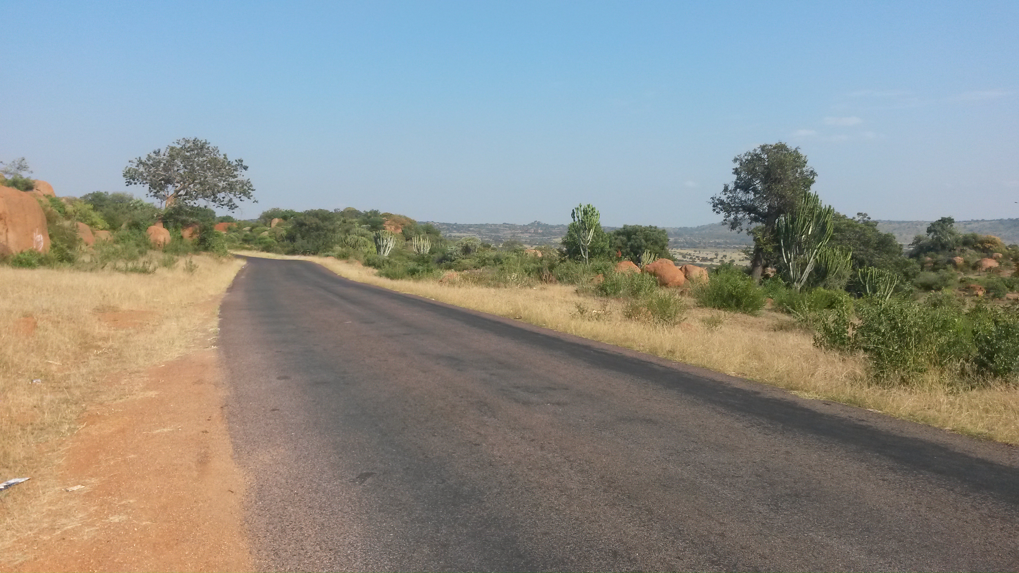
 From here the pave roads ended and turned into a loose gravel. Passing two more new dams the government has built to supply water to these rural communities.
 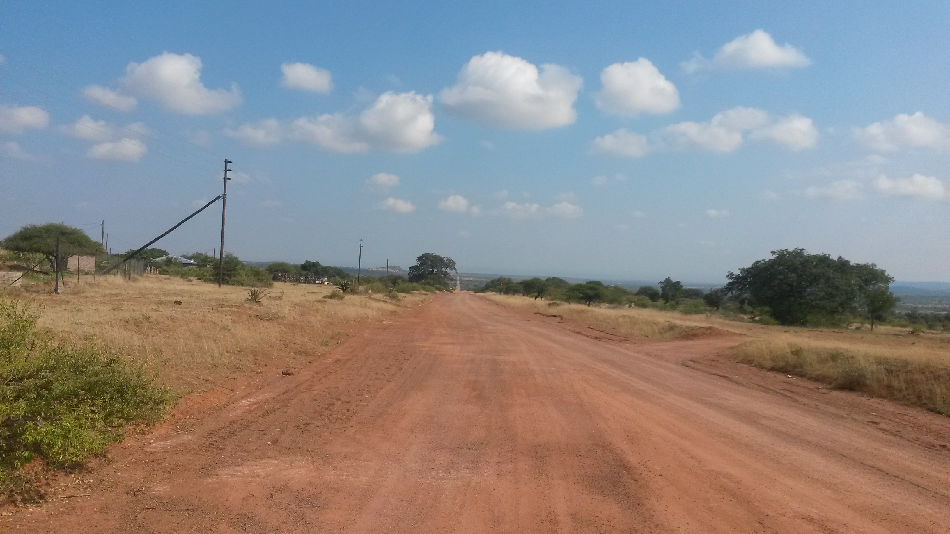 From the last dam it was back to paved roads all the way to Marble Hall. Lunch was in the saddle after stopping at the supermarket in Marble Hall.
Last stretch from Marble Hall to home is my normal training ground. Got home at 15H30 monday. With 720 km and over 5000 m ascents. It turned out to be just the training ride I needed for the Trans-Afrika race. May have to do it again sometime.
